What is Remote Sensing?
- By
- Pooja |
- July 04, 2022 |
- Civil Engineering, Innovation,

Table of Contents
Observing with the Electromagnetic Spectrum
What is Remote Sensing?
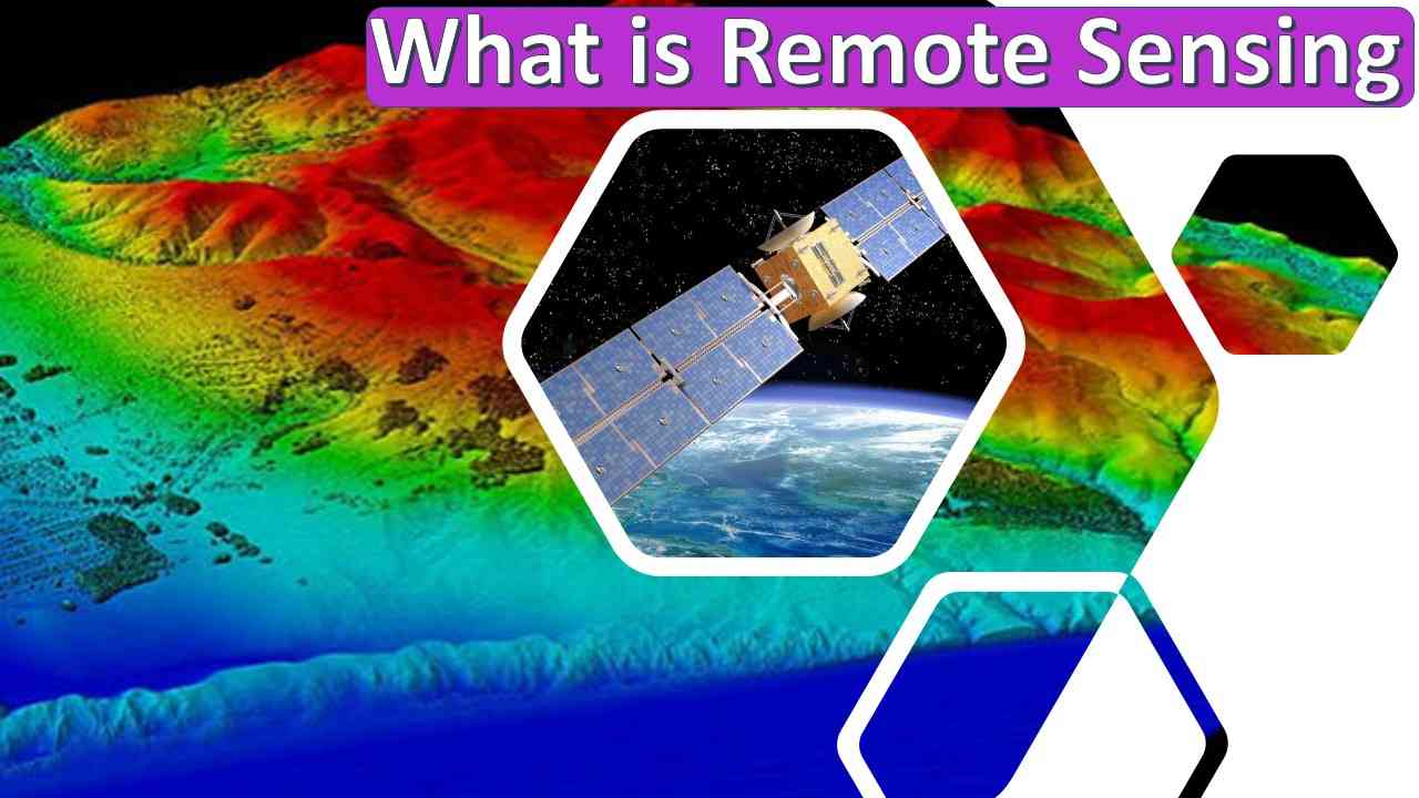
Radiation emitted and reflected by objects in a given region can be detected and monitored using remote sensing techniques (typically from satellites or aircraft). Users can "feel" the Earth's surface with the use of special cameras that collect distant sensed images.
- Using satellite cameras and areal imagery, we can see considerably more of the ground surface than from the ground level.
- Without having to travel to the bottom of the sea, sonar systems on the ships can produce photographs of ocean floors.
- Images of seawater temperature variations can be obtained using satellite cameras.
The following are some specific applications for Earth photos captured using remote sensing:
- For huge forest fires, satellite mapping allows rangers to observe more of the region than they would be able to on the ground.
- Predicting the weather through watching clouds and volcanoes erupt, as well as seeing dust storms.
- Tracing changes in farms or forests over the course of several years or decades to see how a city is growing.
- Discovery and charting of the ocean floor's severe terrain (such as massive mountain ranges, deep gorges, and the "magnetic striping" over the ocean floor).
Application of Remote Sensing
Remote sensing comes with a broad range of uses, which can be categorized as follows:
- Resource Exploration: Remote sensing is used by geologists to research the origin of sedimentary rocks, identify mineral resources, locate oil reserves, and locate subsurface water reservoirs. – Coral reef mapping and other aquatic treasures can be discovered through remote sensing.
- Environmental Study: Cloud motion and rainfall can be studied and forecasted using remote sensing. Water outflow from diverse enterprises can be studied using satellite data to determine the dispersion and detrimental impacts on living species if any. It is possible to study oil spills and oil slicks by applying advanced remote sensing methods.
- Land Use: By applying remote sensing, enormous areas can be mapped in a short duration. Areas such as forests, farms, cities, and factories can all be assessed and monitored on a regular basis. A variety of crops can be identified.
- Site Investigation: Using remote sensing in dam and bridge site assessments is a common practice. Construction supplies like sand and gravel can be found using this tool.
- Archaeological Investigation: Many past structures are buried beneath the surface and are unknown to the general public. However, remote sensors are able to identify archaeologically significant buried structures by analyzing changes in the moisture content and other features of the buried artefacts and the new upper layer.
- Natural Hazard Study: It is possible to foresee and limit the effects of these natural hazards by applying remote sensing.
- Earthquake
- Volcanoes
- Landslides
- Floods and
- Hurricane and Cyclones
Read More:
Types of Remote Sensing
Active Sensor
The primary distinction between passive sensors and active sensors is that the latter lights the object they are trying to detect. Active sensors then measure the reflected light. For instance, Radarsat-2 is a synthetic aperture radar (SAR) active sensor. Consider the light from a camera flash. It makes its mark more visible. The reflected light is then captured. This is exactly how active sensors function.
Passive Sensor
The sun's reflected light is measured via passive sensors. Passive sensors collect light reflected from the Earth's surface. Passive sensors include satellites like Landsat and Sentinel. Reflected sunlight in the electromagnetic spectrum is used to capture photographs.
The sun's reflected energy is used in passive remote sensing. In contrast, active remote sensing illuminates its target and measures its backscatter.
Importance of Remote Sensing
The use of remote sensing to gather data from inaccessible locations is becoming increasingly important in today's society. For common uses, such as weather forecasts or reports on natural disasters or climate change, it replaces laborious, costly data collecting on the ground with fast and repeating coverage over enormously wide areas.
Since it does not harm the target region or object in any way, remote sensing is also a non-intrusive method of data collection, processing, and GIS analysis. For example, geographic remote sensing techniques are also used to monitor floods, forest fires, polar bears, chemical concentrations, and earthquakes, which would otherwise be impossible to monitor.
Observing with the Electromagnetic Spectrum
Charged particle vibrations generate electromagnetic energy, which propagates as waves across the atmosphere and the vacuum of space. Depending on their wavelengths (the distance between the crests of the waves), these waves have a wide variety of frequencies.
Some waves, like radio and microwave, have a longer wavelength while others, like ultraviolet and x-rays, have a considerably shorter one. These include infrared, infrared, and microwave waves. Long-wave and short-wave radiation are both included within the continuum of visible light. The human eye is only able to perceive a small part of this radiation.
All other forms of electromagnetic energy must be detected via instruments. The complete spectrum of the electromagnetic spectrum is used by NASA instruments to study processes on Earth and other planetary bodies.
There are some wavelengths of light that can travel through the atmosphere unhindered, such as visible light; these wavelengths have wavelengths that are absorbed or reflected by water vapour and carbon dioxide. Many meteorological and communication satellites rely on the ability of microwave energy to flow through clouds.
The Sun is the major energy source detected by satellites. Depending on how rough the surface is and its albedo (the ability of a surface to reflect rather than absorb light), the number of the Sun's rays reflected can vary widely.
For example, snow has an extremely high albedo and it reflects roughly 90% of the incoming solar energy. The ocean or sea, on the other hand, only reflects around 6% of the inbound solar radiation and soaks up the rest.
When energy is soaked-up or absorbed, it is frequently re-emitted, normally at longer wavelengths. Infrared radiation, for example, is emitted as a byproduct of ocean energy absorption. The amount of energy that can be absorbed, reflected, or transmitted by any object on Earth depends on the wavelength.
Everything on the planet has a distinctive spectral fingerprint, just like our fingerprints are unique for each person. It is possible to distinguish different types of rocks and minerals using this information. To establish how much variation can be discerned between materials using an instrument, its spectral resolution must be considered.
History of Remote Sensing
Remote sensing" is a relatively recent word, first coined in the 1960s to characterise the field. Despite the fact that the phrase "remote sensing" was not developed until the mid-20th century, the practice of remote sensing dates back approximately 150 years.
Aerial photography is the first form of remote sensing. This all began with the advent of the camera in the late 1800s. Inventor Nicéphore Niépce produced the first effective pictures in the early 1800s. People began shooting aerial photos soon after photography was developed. Balloons were used to take the earliest aerial photos.
The first aerial photograph was taken in 1850 by Gaspard-Félix Tournachon, better known as Nadar under his pseudonym. The first effective aerial shot of a French village was taken by Nadar in 1858 when he used a hot air balloon. Unfortunately, none of these early aerial pictures has survived. James Wallace took an aerial shot over Boston in 1860, which is the earliest known as an aerial photograph. Nadar's oldest known aerial photograph was shot from a hot air balloon over Paris in the year 1866.
In the early twentieth century, remote sensing was a relatively new technology.
I hope the blog provides you with in-depth knowledge of Remote Sensing and its associated features.
Please feel free to like, share and comment.
Admin, gcelab.com
Please see our Pillar Post to know why we founded gcelab.com.
Read More:

Pooja
Founder at gcelab.com, Pooja is an Entrepreneur unlocking human potential. Working in the Principles of Lean Start-up, Pooja believes in Transparency and User Happiness the most. Pooja’s background in teaching gives her a sophisticated grasp on even the most tedious aspect of course building. She is passionate about people who believe that good is not enough.
Previous Post
What is the Purpose of Embankment?
Next Post


