Importance of surveying in Civil Engineering
- By
- Pooja |
- February 13, 2022 |
- Civil Engineering, Highway Engineering,

Table of Contents
What are the roles of the survey in Construction?
What are the field applications of surveying?
Brief Details about Theodolite
Important aspects of Total Station in Surveying
What is Surveying?
Surveying or land surveying is the process of establishing a point's three-dimensional or terrestrial location, as well as the distance and angle between that point and other locations. If you're a land surveyor, you're a professional in the field.
These points are often found on the Earth's surface and are frequently used to create maps and borders for property ownership, as well as for other reasons such as the intended placements of structural components for buildings or the surface location of subterranean objects.
Engineers, geometers, trigona-metrists, physicists, mathematicians, physicists, statisticians, and lawyers all have a hand in surveying. A variety of tools, including theodolites, theodolites with robotics, total stations, LiDAR sensors, radios, inclinometers, portable tablets, optical and digital levels, subsurface locators and drones, as well as GIS and other surveying software, are used by these surveying professionals.
What are the roles of the survey in Construction?
A surveyor's responsibilities include the following.
- It is the job of surveyors to determine the distance and angle between two places on the ground surface.
- It is possible to find some significant characteristic points by going in accordance with specific reference points.
- The records pertaining to land, survey, and land titles are thoroughly examined.
- To find the current boundary lines, look for the old boundary lines that are still visible on the property.
- The research is carried out, and the outcomes are documented. After that, they are checked for correctness and any necessary modifications are made.
- The reports of the surveyed site are created using the surveyed records, plots, and maps.
- Results of surveys are delivered to businesses and government organisations for their consideration.
- The official requirements for land and water have been determined. These may either be leased out or purchased with a deed.
- Important instruments used for surveying
What are the field applications of surveying?
Surveying plays a significant role in civil engineering. Without surveying, there is no way to ensure that the building process is safe and efficient. To begin any design or construction project, civil engineers must conduct surveys.
The survey offers all of the background information and clearance needed to carry out construction work in a safe, efficient, and cost-effective way. There are many uses for surveying, and I've included most of them below.
Surveyors work with the elements such as.
- Geometry
- Trigonometry
- Regression analysis
- Physics
- Engineering
- Meteorology
- Programming languages, and
- Law and many others.
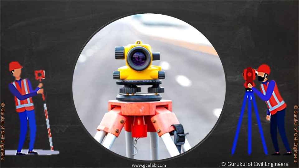
Surveyors use equipment like Theodolite, Total Station, Digital levels,3-D scanners, Drones, GIS, and some other supporting equipment and surveying software for various purposes.
Brief Details about Theodolite
It is possible to determine the angle between two locations in the vertical and horizontal planes by using a theodolite /Idlat/, which is a very accurate optical tool. Land surveying is the classic use, but it is also widely employed in the construction of buildings and infrastructure, as well as in other specialist fields like meteorology and rocket launching.
Angular readings are provided using a movable telescope positioned in such a way that it may revolve about horizontal and vertical axes. Using the theodolite position and the first point seen via the telescope, these coordinates are used to determine the telescope's orientation
Microradians or seconds of the arc can be used to accurately measure these angles. From those readings, a plan can be populated in line with a pre-existing plan. Modern theodolites have evolved into total stations, that use electronic sensors to measure and transmit data to a computer.
Unlike non-transit theodolite instruments, a transit telescope's trunnion axis is sharp enough to spin around, allowing the telescope to be turned across the vertical plane from horizon to horizon.
When used for levelling along a horizontal plane, optical levels are frequently confused for theodolites, which measure vertical angles (frequently combined with the moderate precision horizontal range and directional measurements).
A sequence of procedures known as temporary adjustments is required to get a theodolite set up at a station in order to conduct observations. A total of four phases are involved in achieving these goals, which comprise the following:
Installing the theodolite on a tripod and roughly levelling and centring it over the station mark are the first steps in the setup process.
When a theodolite's vertical axis is brought directly on top of the station mark with the help of a centring plate (also termed as a tribrach), it is known as centring the instrument.
An in-built bubble level is used to ensure that the instrument's vertical axis is level.
Read More:
- 30 Most demanding and useful design software for Civil Engineers
- What is Swept Path Analysis? 6 Important Points
- What is Topographical Survey? 10 Important Points
Correctly focusing the objective and eyepiece removes parallax errors. There is only one adjustment needed for the eyepiece. Because of the varying distances between this station and the target, the objective will need to be re-engaged for each successive sighting.
The surveyor uses the telescope to align the cross-hairs with the intended sighting point and then takes measurements. Either the visible or internal scales are normally used to read and record the two angles. Seeing and recording the next item is accomplished while keeping the device and tripod's original location.
Open vernier scales are normally used for the initial angular readouts, which is clearly apparent to the human eye. By using complex light channels to get the scales to an easy-to-see location in front of the device, they are eventually transformed into indirect optical readouts. The electronic displays on the newer digital theodolites are the latest features.
Important aspects of Total Station in Surveying
The surveyor uses the telescope to align the cross-hairs with the intended sighting point and then takes measurements. Either the visible or internal scales are utilized to read and record the two angles. Seeing and recording the next item is accomplished while maintaining the device and tripod's original location.
Open vernier scales were utilized for the initial angular readouts, which were clearly apparent to the human eye. By using complex light channels to get the scales to an easy-to-see location in front of the device, they were eventually transformed into indirect optical readouts. The electronic displays on the newer digital theodolites are a feature.
“Prism reflectors or the target item can be used to reflect an infrared carrier signal, which can be used to measure distance. The carrier signal can be created by a tiny solid-state emitter within the instrument's optical path. The computer in the total station reads and interprets the returned signal's modulation pattern.
Multiple frequencies are emitted and received, and the wavelength to the target is obtained by finding the integer number of wavelengths per frequency. For the EDM signal, the majority of the total stations employ custom-made glass prism reflectors (surveying devices).
With an accuracy of 1.5 millimetres (0.059 in) and 2 parts per million, the average total station can measure lengths of up to 1,500 metres (4,900 ft).
A hand-held computer or other external data collectors can be used with certain versions, while others include built-in electronic data storage for distance, horizontal angle, and vertical angle readings.
There are several applications that may be used to analyse the collected data from a total station and provide a map of what was discovered. Total stations of the most recent generation may display a map on the instrument's touch-screen instantly after measuring the points.
Please feel free to like, share and comment.
Admin, gcelab.com
Please see our Pillar Post to know why we founded gcelab.com.
Read More:
What is Stopping Sight Distance? 6 Important Points
How to design a Roundabout? 4 Important Points

Pooja
Founder at gcelab.com, Pooja is an Entrepreneur unlocking human potential. Working in the Principles of Lean Start-up, Pooja believes in Transparency and User Happiness the most. Pooja’s background in teaching gives her a sophisticated grasp on even the most tedious aspect of course building. She is passionate about people who believe that good is not enough.
Previous Post


